
Hutton’s Place
Off Summerhill, this very short lane has a convoluted history, name-wise.
Listed as ‘Hutton’s Lane’ in 1833,1 by 1841 it was called ‘Mountjoy Place, Lower’.2 That name lasted until 1861, after which it reverted to ‘Hutton’s Lane’.3
In 1878 the Corporation decided to change the name to ‘Hutton’s Place’, no doubt because of the ‘evil reputation’ attached to the term ‘lane’.4
For some reason this change was not implemented, and in 1902 the Corporation once again decided to change the name.
As set out in the report of the Paving Committee, ‘the majority of the owners in number and value’ requested that the name be changed [back?] to Mountjoy Place.5
The owners’ reasons were that the word ‘Lane’ was ‘wholly unsuitable and most objectionable as a name for this place, in which people of a respectable class reside’.
The Paving Committee agreed with that, but didn’t accept the proposed name, suggesting ‘Hutton’s Place’ instead. This was accepted by the owners, and this time the change in name did take effect.6
The name ‘Hutton’ comes from Hutton’s coach builders, who had their premises in Summerhill from 1789.7 In 1902 the business, alongside which the laneway ran, was described as ‘Hutton, Sons, and Co. motor car factory, cycle agents, and Dublin wheel works’.8
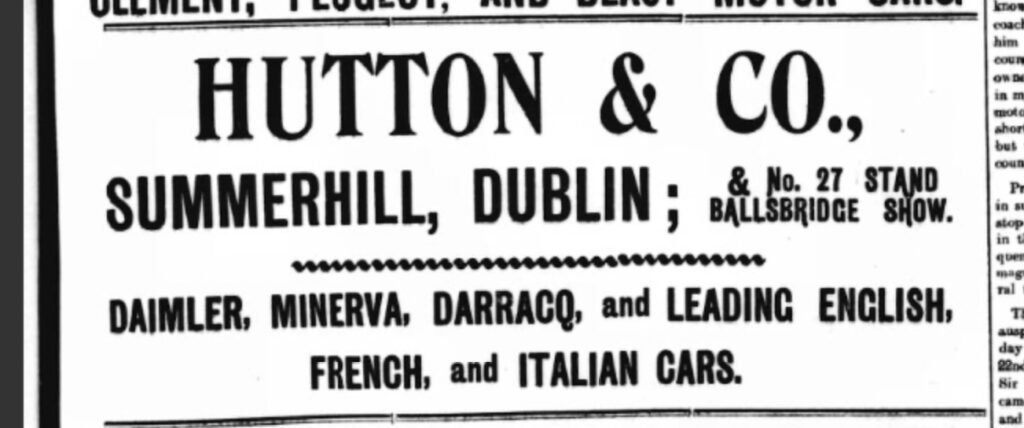
The laneway was incorporated into the Summerhill Bus Garage at some point in the early 1950s; both my mother and my cousin remember using the laneway to get to the shops in Summerhill. It’s not shown on the OS map of 1953.9
- Post Office Annual Directory for 1833. ↩︎
- Pettigrew & Oulton’s Dublin Almanac and General Register of Ireland for the Year 1841 (Dublin, 1841).
↩︎ - Thom’s 1862. ↩︎
- Reports 1879/06. ↩︎
- Reports 1902/150. ↩︎
- Thom’s 1903. ↩︎
- Jim Cooke, ‘Hutton, John’, in Dictionary of Irish Biography (https://doi.org/10.3318/dib.004183.v1) (accessed 10 March 2025). ↩︎
- Thom’s 1902. ↩︎
- Ordnance Survey of Ireland, 2.5” map, Dublin, 1953 (https://collections.lib.uwm.edu/digital/collection/agdm/id/5864/rec/11)(accessed 10 March 2025). ↩︎