
Connaught Street
Off Phibsborough Road, this is one of four streets, forming, more-or-less, a square, named for the four provinces of Ireland.
It’s shown on Taylor’s map of 1816 as Forsagh Lane,1 and as Faussagh Lane on the various editions of the Ordnance Survey.2
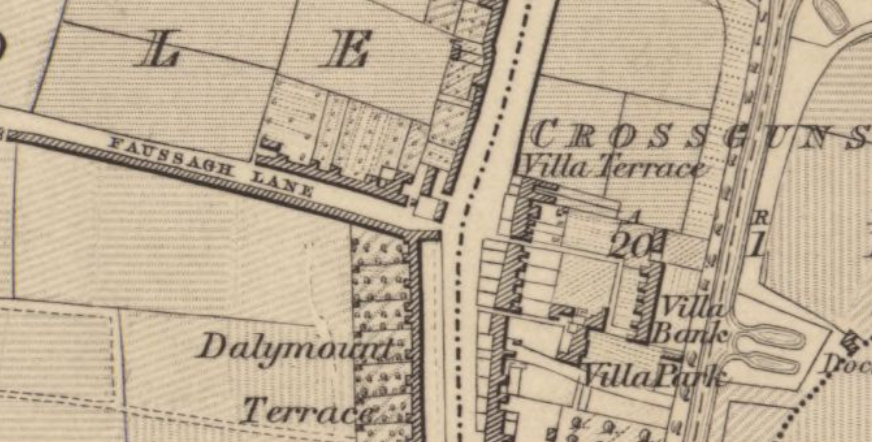
It’s first listed in Thom’s, as Faussaght Lane, in 1850, with 50 small tenements.3 Two years later a house called Mount Bernard is listed.4
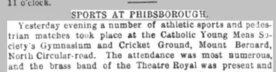
This house stood on the site of the present Mount Bernard Park, and in the 1860s it was the home of the Catholic Young Men’s’ Society’s gymnasium and cricket ground.5 It seems to have been demolished in the late 1900s.6
The building of the houses on Faussagh Lane began in the late 1870s, and the name ‘Connaught Street’ is first recorded in 1881. The development of the street can be traced in Thom’s from then, and building continued into the twentieth century.7
As was common at the time, the houses, as they were built, were numbered as terraces. In 1897, for example, Providence Terrace, Ethnea Terrace, Cahal’Mer Terrace, and Downham Terrace, are listed in the street directory.
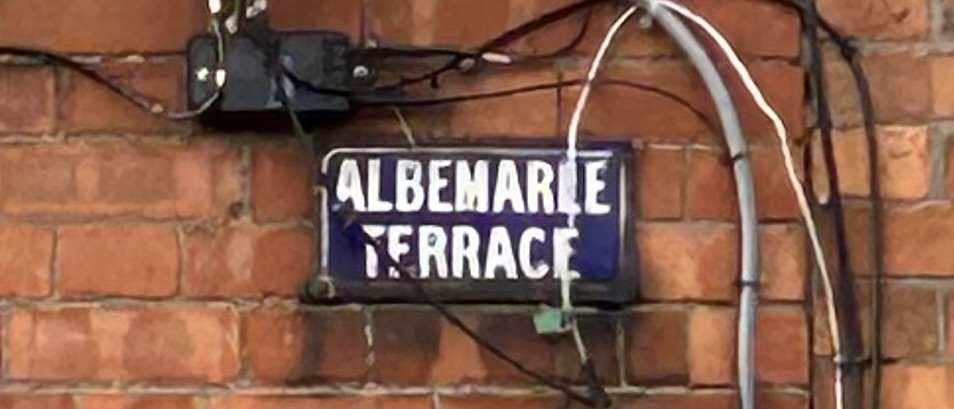
This is an example of Thom’s being mistaken: although Providence and Downham terraces are correct, Cahal’Mer terrace, a nonsensical name, can only be a corruption of the actual name Albermarle terrace.
(I have no idea where Thom’s got Ethnea terrace from, but it strikes me as nonsense as well.)
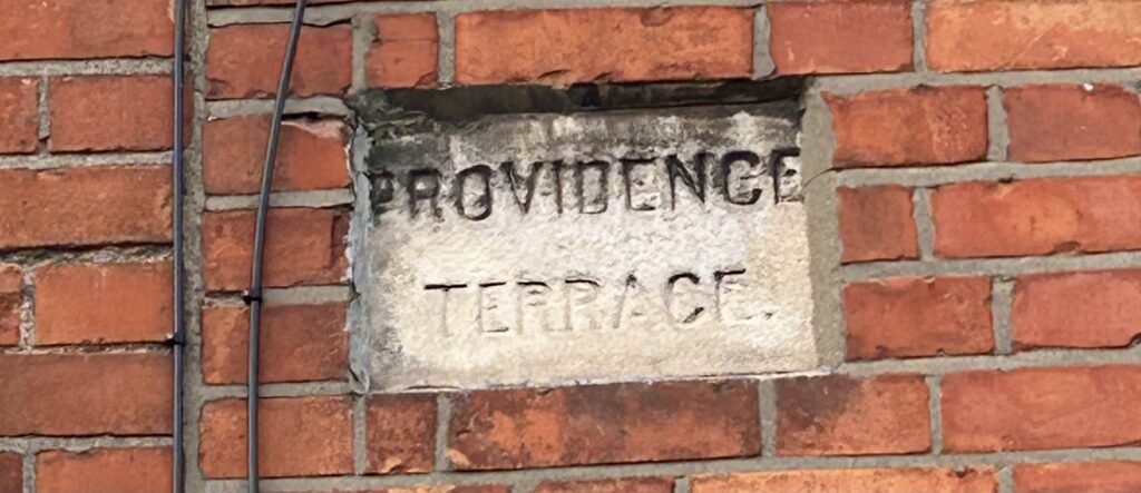
There are four name plates for terraces still existing on Connaught Street, these being for Albermarle, Providence, Downham (the latter barely legible), and Gunning terraces.
Numbering houses by terrace, rather than street, caused problems and in 1905 the Corporation directed the Borough Surveyor to sort out the numbering of the houses.8
- John Taylor, Map of the City and Environs of Dublin (Dublin, 1816).
- Ordnance Survey of Ireland, 6‑inch map, Sheet 18 (County Dublin), surveyed 1837, revised 1907–08 (published 1912).
- Thom’s, 1850.
- Thom’s, 1852.
- ‘Sports at Phibsboro’, Evening Freeman, 07 July 1863.
- Bernard Neary, Dublin 7 (Dublin, 2016), p. 206.
- Thom’s, 1881, and passim.
- Reports 1905/24.
One Comment