
James Joyce Street
Laid out in the early 1700s, this street was named ‘Mabbot Street’ as early as 1721, when it was reported that complaints had been received from residents of the Strand about ‘… the dirt and filth of the streets and markets being laid down there by the city carts, which doth occasion a great stench, and is prejudicial to the several inhabitants…‘1
In response the Corporation leased land from John Moland, on Mabbot Street, as ‘a convenient place to lay down the said dirt‘.
The street was named after Gilbert Mabbott, who built a mill at the location in the late 1600s.3
As with other streets in the locality – see Railway Street – the name acquired an ‘evil reputation’, and in 1911 the residents asked that the name be changed to ‘Corporation Street’, stating that:
If the name of the street is changed it would be a means of letting the Corporation Buildings to respectable tenants, which would be a great benefit to shopkeepers of this district, and a benefit to the workers living therein.4
The name was accordingly changed to ‘Corporation Street’ on 13 November 1911.5
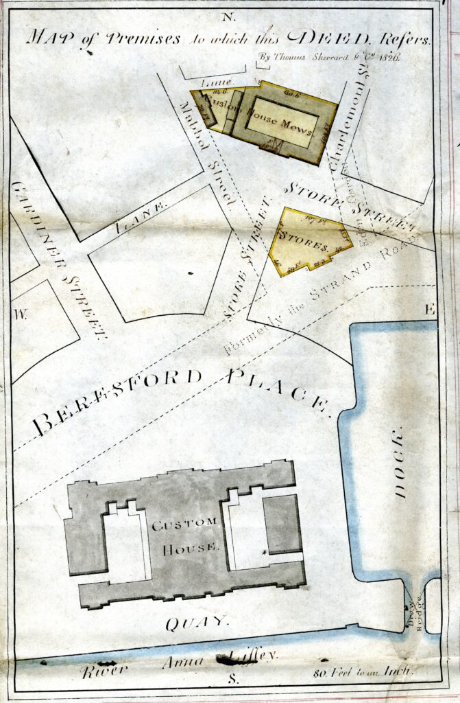
As late as 1943, the name Corporation Street applied to the stretch from Frenchman’s Lane to Railway Street, However, from 1944, Thom’s describes it as running from Talbot Street to Railway Street.6 It wasn’t until 1956 that Thom’s applied the name Store Street to the section from Frenchman’s Lane to Talbot Street,7 which it still bears.
The Corporation Buildings were demolished in the early 1970s, and by the end of the century the street had deteriorated to the extent that only two occupiers remained. It was proposed in 2000 to change the name to ‘James Joyce Street’ and, following a plebiscite of the two occupiers, in which only the Corporation itself voted, the new name was adopted on 5 February 2001.8
- CARD, vii, p. 180.
- Sherrard and Co., Map of Premises to Which This Deed Refers (Dublin City Library and Archive, 30 Aug. 2021), Digital Repository of Ireland, https://doi.org/10.7486/DRI.kd17sc737.
- M’Cready, p. 62; CARD, vi, p. 388.
- Reports 1911/174.
- Minutes 1911/760.
- Thom’s, 1944.
- Thom’s, 1956.
- Reports 2001/55.
3 Comments